
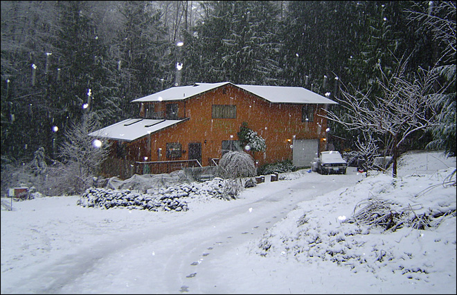
The National Weather Service on Sunday and today issued a blizzard warning for higher elevations of the North Olympic Peninsula, coupled with a high-wind warning along coastal elevations.
Good news: The original high-wind and blizzard warnings were downgraded this morning to subside around noon.
In the Weather Service’s style of all-capital letters and dot.dot.dot, here are weather bulletins. Refer to http://www.wrh.noaa.gov/sew for the latest information.
For a discussion of weather forecasts across Western Washington, visit our Seattle news partner KOMO-TV: http://www.komonews.com/news/local/Weather-warnings-issued-as-potent-storm-approaches-W-Wash-183705641.html
Weather Service bulletins:
Blizzard Warning
URGENT – WINTER WEATHER MESSAGE
NATIONAL WEATHER SERVICE SEATTLE WA
459 AM PST MON DEC 17 2012
WAZ513-172100-
/O.NEW.KSEW.WW.Y.0044.121217T2000Z-121218T0200Z/
/O.EXT.KSEW.BZ.W.0001.000000T0000Z-121217T2000Z/
OLYMPICS-
459 AM PST MON DEC 17 2012
…BLIZZARD WARNING NOW IN EFFECT FOR THE OLYMPICS ABOVE 1000 FEET
UNTIL NOON PST TODAY…
…WINTER WEATHER ADVISORY IN EFFECT FROM NOON TODAY TO 6 PM PST
THIS EVENING…
THE NATIONAL WEATHER SERVICE IN SEATTLE HAS ISSUED A WINTER
WEATHER ADVISORY FOR BLOWING SNOW…WHICH IS IN EFFECT FROM NOON
TODAY TO 6 PM PST THIS EVENING.
* SOME AFFECTED LOCATIONS…HURRICANE RIDGE.
* WIND…WESTERLY 30 TO 40 MPH WITH GUSTS TO 55 MPH CAN BE EXPECTED
ACROSS SOME AREAS THIS MORNING. THE WINDS WILL DECREASE ABOUT
MIDDAY.
* VISIBILITY…NEAR ZERO AT TIMES IN SOME AREAS THIS MORNING DUE
TO BLOWING OR DRIFTING SNOW. AREAS OF BLOWING OR DRIFTING SNOW
CAN BE EXPECTED THIS AFTERNOON BUT WITH LESS WIND…CONDITIONS
WILL NOT BE AS POOR AS THIS MORNING.
* SNOW ACCUMULATIONS…ANOTHER 3 TO 6 INCHES IS LIKELY TODAY.
* MAIN IMPACT…HURRICANE RIDGE ROAD IS CLOSED TODAY.
PRECAUTIONARY/PREPAREDNESS ACTIONS…
A BLIZZARD WARNING MEANS SEVERE WINTER WEATHER CONDITIONS ARE
EXPECTED OR OCCURRING. FALLING AND BLOWING SNOW WITH STRONG WINDS
AND POOR VISIBILITIES ARE LIKELY. THIS WILL LEAD TO WHITEOUT
CONDITIONS…MAKING TRAVEL EXTREMELY DANGEROUS. DO NOT TRAVEL. IF
YOU MUST TRAVEL…HAVE A WINTER SURVIVAL KIT WITH YOU. IF YOU GET
STRANDED…STAY WITH YOUR VEHICLE.
THIS IS AN EXTREMELY DANGEROUS SITUATION. CONSIDERABLE BLOWING
AND DRIFTING SNOW WILL CREATE WHITEOUT CONDITIONS AND MAKE
ROADWAYS IMPASSABLE. IF YOU BECOME STRANDED…THE SITUATION COULD
BECOME LIFE THREATENING.
FOR THE STATUS OF HURRICANE RIDGE ROAD…CALL 360-565-3131 OR
VISIT WWW.NPS.GOV/OLYM/INDEX.HTM.
————————–
High Wind Warning
URGENT – WEATHER MESSAGE
NATIONAL WEATHER SERVICE SEATTLE WA
526 AM PST MON DEC 17 2012
WAZ001-506-510-514-515-172000-
/O.EXT.KSEW.HW.W.0011.000000T0000Z-121217T2000Z/
SAN JUAN COUNTY-WESTERN SKAGIT COUNTY-ADMIRALTY INLET AREA-
EASTERN STRAIT OF JUAN DE FUCA-WESTERN STRAIT OF JUAN DE FUCA-
526 AM PST MON DEC 17 2012
…HIGH WIND WARNING NOW IN EFFECT FOR SAN JUAN COUNTY…ADMIRALTY
INLET AREA…AND THE STRAIT OF JUAN DE FUCA UNTIL NOON PST TODAY…
* SOME AFFECTED LOCATIONS…OAK HARBOR…ANACORTES…PORT ANGELES…
AND FRIDAY HARBOR.
* WIND…WESTERLY WIND 20 TO 35 MPH WITH LOCAL GUSTS TO 60 MPH
THIS MORNING WILL DIMINISH TO 15 TO 30 MPH WITH GUSTS NEAR 45
MPH BY MIDDAY. THE STRONGEST WINDS WILL LIKELY BE OVER WHIDBEY
ISLAND EXPOSED TO THE STRAIT OF JUAN DE FUCA WATERS.
* IMPACTS…HIGH WINDS CAN TOPPLE TREES…DOWN POWER LINES…
DAMAGE PROPERTY…AND CAUSE POWER OUTAGES.
PRECAUTIONARY/PREPAREDNESS ACTIONS…
MOTORISTS…ESPECIALLY THOSE WITH HIGH PROFILE VEHICLES…SHOULD
BE ALERT FOR SUDDEN…STRONG CROSS WINDS.
A HIGH WIND WARNING MEANS DAMAGING WINDS OF AT LEAST 40 MPH
AND/OR GUSTS OF 58 MPH OR HIGHER ARE IMMINENT OR OCCURRING.
Coastal Flood Advisory
COASTAL HAZARD MESSAGE
NATIONAL WEATHER SERVICE SEATTLE WA
1106 PM PST SUN DEC 16 2012
…HIGH SURF WILL ARRIVE ALONG THE COAST MONDAY…
…MINOR TIDAL OVERFLOW IS POSSIBLE AT HIGH TIDE MONDAY…
.A STRONG LOW PRESSURE SYSTEM WILL MOVE THROUGH WESTERN
WASHINGTON EARLY MONDAY MORNING. TIDES WILL BE HIGHER THAN THE
TIDE TABLE PREDICTIONS MONDAY MORNING. HEAVY SURF WILL ALSO
ARRIVE ALONG THE COASTAL BEACHES MONDAY.
WAZ516-517-171900-
/O.CON.KSEW.CF.Y.0009.121217T1000Z-121217T1400Z/
/O.CON.KSEW.SU.Y.0011.121217T1000Z-121218T1200Z/
NORTH COAST-CENTRAL COAST-
1106 PM PST SUN DEC 16 2012
…COASTAL FLOOD ADVISORY REMAINS IN EFFECT UNTIL 6 AM PST
MONDAY…
…HIGH SURF ADVISORY REMAINS IN EFFECT UNTIL 4 AM PST TUESDAY…
* HAZARD…TIDAL OVERFLOW POSSIBLE AT HIGH TIDE…ALSO HIGH SURF
OF 20 TO 25 FEET WILL ARRIVE ALONG THE COAST MONDAY.
* IMPACTS…BIG WAVES WILL MAKE THE BEACHES DANGEROUS MONDAY.
* TIME OF HIGH TIDE…3 TO 4 AM AND AGAIN AROUND 3 PM MONDAY.
* TIDE TABLE PREDICTION…WESTPORT 9.3 FEET AND LA PUSH 8.5 FEET
WITH BOTH TIDES.
* EXPECTED TIDAL ANOMALY…ADD 2.5 FEET TO THE TIDE TABLE
PREDICTION WITH THE FIRST HIGH TIDE DECREASING TO 1 FOOT FOR
THE AFTERNOON HIGH TIDE.
PRECAUTIONARY/PREPAREDNESS ACTIONS…
A HIGH SURF ADVISORY MEANS THAT HIGH SURF WILL AFFECT BEACHES IN
THE ADVISORY AREA…PRODUCING RIP CURRENTS AND LOCALIZED BEACH
EROSION. BEWARE OF SNEAKER WAVES AND STAY OFF BREAKWATERS AND
JETTIES.
THE COASTAL FLOOD ADVISORY FOR MINOR TIDAL OVERFLOW INDICATES
THAT LOW LYING AREAS ALONG THE SHORE MAY SEE MINOR FLOODING AT
HIGH TIDE.
Inland
SAN JUAN COUNTY-WESTERN WHATCOM COUNTY-WESTERN SKAGIT COUNTY-
EVERETT AND VICINITY-SEATTLE/BREMERTON AREA-TACOMA AREA-
ADMIRALTY INLET AREA-HOOD CANAL AREA-
1106 PM PST SUN DEC 16 2012
…COASTAL FLOOD ADVISORY REMAINS IN EFFECT FROM 7 AM TO 11 AM
PST MONDAY…
* HAZARD…TIDAL OVERFLOW IS POSSIBLE NEAR THE BEACHES.
* TIME OF HIGH TIDE…8 TO 930 AM.
* TIDE TABLE PREDICTION…12.9 FT SEATTLE…9.7 FT PORT
TOWNSEND…10.5 FT CHERRY POINT.
* EXPECTED TIDAL ANOMALY…ADD 1.5 FEET TO THE TIDE TABLE
PREDICTION.
PRECAUTIONARY/PREPAREDNESS ACTIONS…
THE COASTAL FLOOD ADVISORY FOR MINOR TIDAL OVERFLOW INDICATES
THAT LOW LYING AREAS ALONG THE SHORE MAY SEE MINOR FLOODING AT
HIGH TIDE.
