
UPDATE: After lingering into the night, a change in the wind pattern this morning seems to be blowing the smoke from the British Columbia forest fires out of the Peninsula . . .
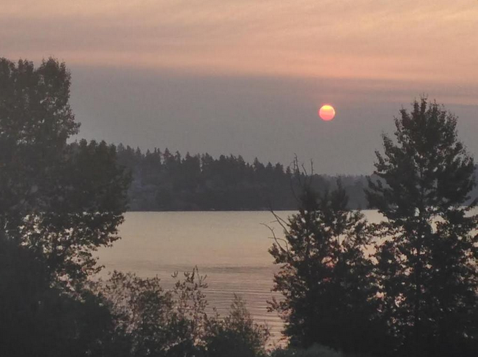
(PHOTO from the National Weather Service in Seattle: “There’s still lots of wildfire smoke in the atmosphere at sunrise this morning.”)
ORIGINAL STORY:
Smoke from several Canadian wildfires surprisingly turned the sky orange Sunday over much of the North Olympic Peninsula with smoke to 20,000 feet from the Pacific Ocean to Whidbey Island.
The smoke came from several large fires burning on Vancouver Island — the Boulder Creek Fire 14 miles northwest of Pemberton, the Dog Mountain Fire at Sproat Lake and the Tsulquate River Fire about 1 mile west of Port Hardy, said Allen Kam, meteorologist for the National Weather Service in Seattle.
Weather patterns funneled the smoke southward from the fires into the Strait, and were expected to continue to do so through at least early this morning, Kam said.
Patterns were expected to shift today and no longer bring the smoke to the Strait, but it will take time for the smoke to dissipate, he said.
Olympic Region Clean Air Agency air quality monitoring stations at Cheeka Peak near Neah Bay, in Port Angeles and in Port Townsend each showed elevated levels of particulates at 5 p.m. Sunday.
At the Port Angeles monitoring station located at Stevens Middle School on the city’s west side, air particles measured received an Washington Air Quality Advisory score of 105, categorized as unhealthy for sensitive groups.
The worse rating is hazardous, a score of 250 or greater.
According to the advisory, the air quality agency recommended that sensitive groups, including people with heart or lung disease, asthma and diabetes, as well as infants, children, adults older than 65, pregnant women or those who have had a stroke should limit time outdoors.
At 5 p.m. Sunday concentrations of air particles measured across the North Olympic Peninsula were still receiving “moderate” alerts, getting scores between 50 and 99.
They were:
■ Cheeka Peak — 94
■ Port Angeles — 95
■ Port Townsend — 90
Those with asthma, respiratory infection, diabetes, lung or heart disease, or have had a stroke should limit outdoor activities or do activities that take less effort, such as walking instead of running, according to the monitoring standards.
Paradise Fire in Olympic National Park
Meanwhile Sunday, managers for the Paradise Fire, burning in Queets River watershed about 30 miles southeast of Forks, said they were receiving smoke and ash fall reports from around the entire North Olympic Peninsula.
Administrators for the fire management are temporarily located at Port Angeles High School.
Little of the Strait of Juan de Fuca smoke is from the Paradise Fire, they said.
The lightning-caused fire in Olympic National Park has not significantly increased its spread or smoke activity, said Donna Nemeth, spokeswoman for the incident team.
Late Saturday, it jumped the Queets River, and firefighters were working Sunday to put out small spot fires on the south bank of the river, Nemeth said.
Some communities on the West End may be getting smoke from both the Queets River and Canadian fires, she said.
Nemeth said the fire, named for Paradise Creek, where it started in May, was estimated to have reached 1,240 acres Sunday morning.
But because the smoke in the Queets River valley is too thick for a flight to measure fire boundaries, the acreage was not certain.
Paradise Fire managers issued advice for those experiencing heavy smoke or ash fall:
■ Hot ash and embers falling could be a sign to call 9-1-1, but cold ash falling is usually not a problem. Ash can travel long distances, and light ash can drop from the sky in cooler temperatures.
■ Reduced visibility is not always an indicator that a fire is close.
■ High drifting smoke is not a threat, and the fire is not likely to be nearby.
The base of any of the smoke columns from the Queets River valley fire is not visible from surrounding communities.
If a smoke column is sighted, call 9-1-1, as this could be a new fire start, Nemeth said.
Quiet weekend on North Olympic Peninsula
The three-day Independence Day holiday weekend was relatively quiet for new fires on the North Olympic Peninsula, with only small blazes that were quickly extinguished, according to emergency dispatch center personnel.
The Olympic Peninsula, Puget Sound and the Western Cascades were under a red-flag warning for critical fire danger through Sunday evening.
There were several small fires reported in Clallam County, but no structures burned and each was extinguished quickly, said Mary Rife, Peninsula Communications dispatch center shift supervisor, on Sunday.
In Jefferson County, a brush fire Saturday afternoon in a clearcut area of Olympic National Forest northwest of Fulton Creek Road and King Drive near the Mason County line, was quickly extinguished.
On Sunday, a hay fire on the 5700 block of Hendricks Street was put out after it was triggered by a cigarette, said East Jefferson Fire-Rescue Chief Gordon Pomeroy.
Outdoor burning bans remain in effect
Comprehensive burn bans have been established in Clallam and Jefferson counties, in all North Olympic Peninsula cities and on lands managed by the state Department of Natural Resources, Olympic National Forest and Olympic National Park.
Both counties, along with the cities of Forks, Port Angeles, Sequim and Port Townsend have banned fires within city limits, including the burning of trash, yard debris, and all recreational fires — including barbecues using charcoal briquettes, pellet-fed smokers or in backyard fire rings.
Briquettes and pellet-fed smokers are banned due to the risks of improper disposal of coals, fire officials have said.
Lands managed by DNR have established the same restrictions as the counties and cities.
The national park, national forest and county parks have banned backcountry campfires but allow campfires — including wood, charcoal and briquette fires — in designated fire rings and grates in developed campgrounds.
Olympic National Forest has banned campfires in four campgrounds “due to the extreme fire potential” in those areas.
Those campgrounds are the Littleton Horse Campground west of Lake Crescent, Lena Lake Campground south of Brinnon, Elkhorn Campground near the Dosewallips River near Quilcene and the Campbell Tree Grove Campground east of Quinault.
There is a ban on open fires in the national park’s wilderness backcountry and all locations along the coast.
Camp stoves still can be used in the park’s wilderness backcountry but should be kept well away from flammable materials, park officials said.
_________
Reporter Arwyn Rice can be reached at 360-452-2345, ext. 5070, or at arice@peninsuladailynews.com.
