
By Annette Cary
Tri-City Herald
RICHLAND — Walking across the Hanford Reach National Monument lands that burned in last week’s Range 12 Fire is an otherworldly experience.
“It looks like a moonscape, to be quite honest,” said Heidi Newsome, biologist for the U.S. Fish and Wildlife Service. “It looks like you are on another planet.”
About half the Arid Lands Ecology Reserve — part of the original security zone around the Hanford nuclear reservation west and southwest of Highway 240 in Southeast Washington — burned.
The reserve is one of the largest remaining intact shrub steppe habitats in the Columbia Basin, much of which is in rapid decline in the West.
This is the third time Newsome has seen all or much of the reserve burn, and the experience gets no easier.
“It’s emotionally hard,” she said. “It’s deflating to put so much work in and see it happen again.”
But each time she’s seen the reserve burn, the results have not been quite as devastating as the time before.
Rehabilitation with native plants after fires in 2000 and 2007 may have helped make the ecosystem more resilient.
And each time the fire has been suppressed with less of the monument land burned.
“We’re doing a better job getting it under control,” Newsome said.
She was advising firefighters Sunday when the decision was made to set Rattlesnake Mountain on fire.
The plan was to create a back burn on the monument as the fire, which started on the Yakima Training Center, swept across the shrub steppe, with only the monument land between the blaze and the contaminated areas of the Hanford nuclear reservation.
Supported decision
She supported the decision to set the fire, which burned from the 1200 Foot Level Road up the steep slopes of Rattlesnake Mountain and over the top.
The controlled burn was necessary to protect people, nearby communities and those fighting the fire, she said.
“We did what needed to be done,” she said.
The fire crossed onto part of the reserve west of the mountain, but the back fire and Range 12 Fire merged late Monday morning, and the blaze died out because it had no more fuel to burn.
It was a much different outcome than in 2000.
The 24 Command fire burned up over the top of Rattlesnake Mountain and moved onto the central part of the Hanford nuclear reservation, threatening radioactive waste stored in the center of the site.
It also burned 11 homes in Benton City. All 77,000 acres of the reserve burned.
In 2007, another blaze that spread much like last week’s fire burned about 55,000 acres of the reserve, but did not reach the peak of Rattlesnake Mountain.
This time, the fire was held at 35,000 acres on the reserve.
Firefighters considered other options to contain last week’s fire, rather than burning Rattlesnake Mountain.
They could have used a bulldozer to carve up the soil and form a line, leaving no vegetation to burn. But that would have meant running over rare plants and cultural areas important to tribes.
“The hope is that for plants at least, since fire is a natural process, they will be able to recover way better than if we would have had a bulldozer dig them out,” Newsome said.
The back burn snaked up Rattlesnake Mountain in the dark of late Sunday and early Monday as people in West Richland watched the lines of fire bright against the mountain.
Firefighters knew that the humidity was higher at night and the fire would not be as hot, reducing its severity.
Some trees and bushes around springs in the canyons down the side of the mountain did not burn.
But elsewhere, much of the habitat that would support animals is gone.
Walking across the blackened earth, Newsome saw dead grasshoppers, praying mantises, beetles and crickets, the foundation of the food chain for birds and mammals on the reserve.
Song birds, like meadowlarks, will move to other areas, increasing competition for food there. They may have trouble gaining the weight they need to sustain their migration. They may migrate early.
The largest impact may be on small mammals, Newsome said.
The seeds they eat are gone and so are the bushes they depend on for shade.
Usually they blend into the tans and browns of the shrub steppe habitat.
But against the now-blackened earth, voles, gophers and mice will be easy prey for coyotes and hawks.
Elk on the reserve had moved up high on the mountain, where green grass could still be found at the end of July. Unlike deer that browse on grass or shrubs, elk are grazers that seek out grass.
Cheat grass should come back on the lower elevations of the burned area in a couple of months, once the fall rain starts.
But until then elk will be on the move.
They may roam to private land, where they could damage crops.
Or some may move down to the Columbia River or to the Yakima Training Center, Newsome said. The Rattlesnake Hills herd now is estimated at about 900 elk.
Two of Newsome’s biggest concerns are wind and cheat grass.
Cheat grass, which is not native, moves in quickly after fires, carpeting the ground with grass that spreads any fire quickly. It also will crowd out native grasses, which grow in bunches.
And wind could blow off the topsoil that plants need to germinate and grow, she said.
Firefighters were able to save Umtanum Desert Buckwheat, an endangered plant that grows only in the area of the Hanford Reach National Monument.
But Newsome remains concerned about other rare plants, like two types of of milkvetch, Piper’s daisy and gray cryptantha.
Historically, they’ve survived fire. But those fires happened only every 80 to 100 years.
Is adaption possible?
The question now is if they can adapt to fires that are burning across their habitat on average every decade, Newsome said.
Any Wyoming big sagebrush, the most common sage in this area, that burned at lower elevations of the fire will not recover, she said.
But three-tip sagebrush, a smaller sage that grows at higher elevations, should come back on its own.
The issue is time.
Following the 2000 fire and some other smaller fires, $6 million was spent to restore the Hanford Reach National Monument, including planting Wyoming big sagebrush.
Much of the sage, planted east of the 1200 Foot Level Road, survived the fire.
But the Wyoming big sagebrush and three-tip sagebrush coming back after the 2000 fire had yet to reach full maturity, Newhouse said. That can take 25 years.
The native bunch grasses took three to four years to recover from the 2000 and 2007 fires.
Biologists began a burn-severity assessment last week on the reserve, and initial results are promising.
They found low to moderate severity, Newsome said, as the fire was not as fast-moving and hot as earlier fires.
U.S. Fish and Wildlife Service officials had planned to resume tours on the reserve, including Rattlesnake Mountain, next year following consultations with area tribes, as ordered by federal court. The reserve is closed to the public except for occasional tours.
Officials are not ready to say there will be no tours in 2017.
Spring, when wildflower tours have been offered in the past, may be too soon, said Dan Haas, the visitors services manager for the Mid-Columbia River National Wildlife Refuge.
But maybe by fall, limited guided tours may be possible again.

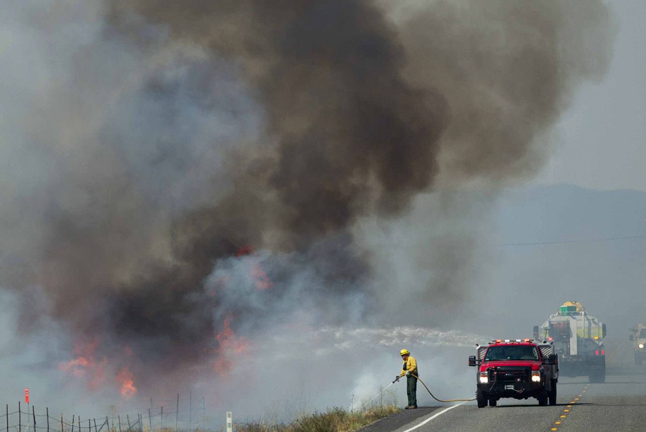
A firefighter tends to a wildfire between Moxee and Sunnyside on Sunday, July 31. (Sofia Jaramillo/Yakima Herald-Republic via AP)
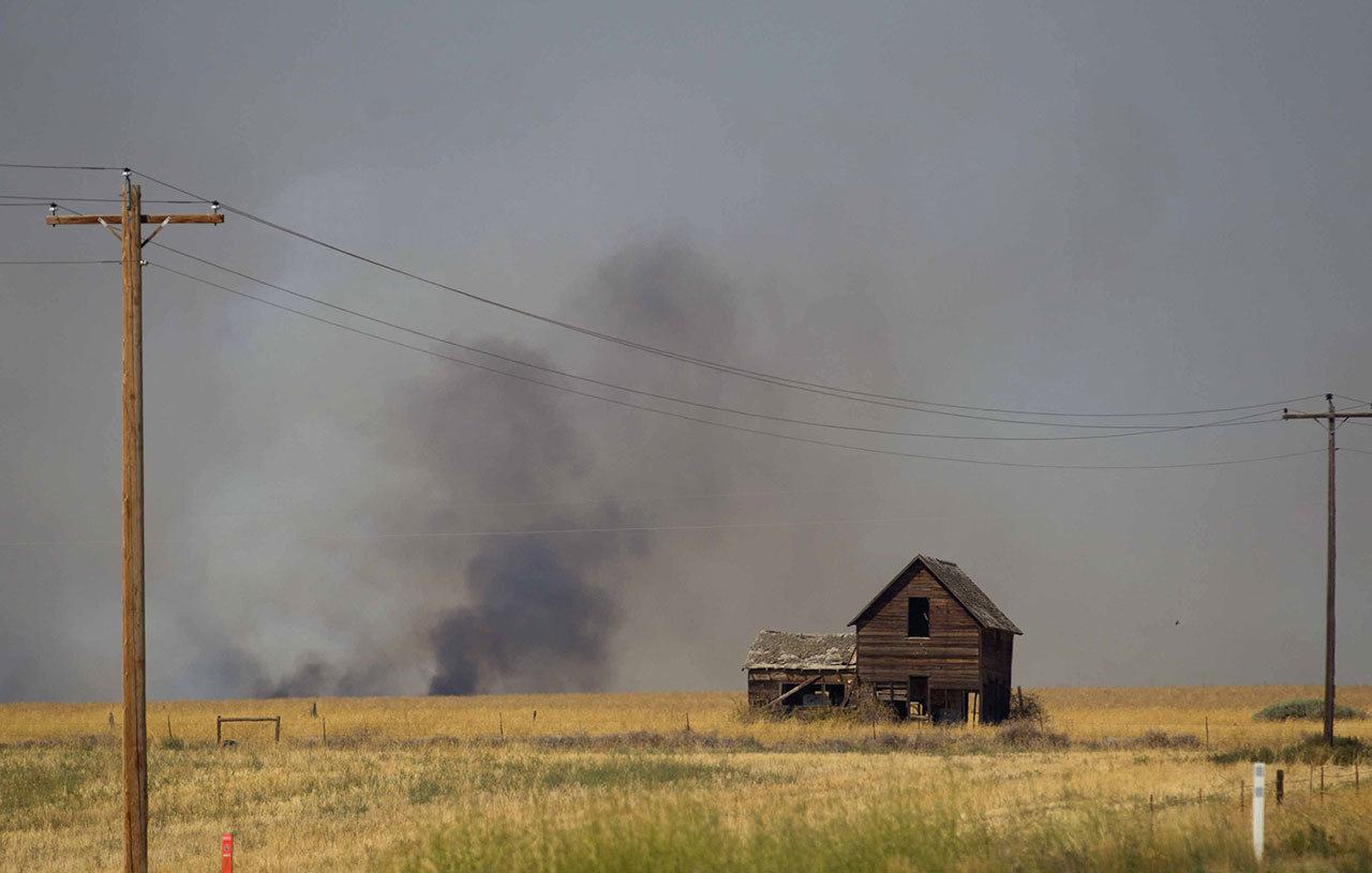
A wildfire burns between Moxee and Sunnyside on Sunday, July 31. (Sofia Jaramillo/Yakima Herald-Republic via AP)
