
PORT TOWNSEND — Drenching, blustery weather that left Jefferson County largely unscathed should dissipate by this morning, according to the National Weather Service.
But there’s a catch: Snow might fall in Jefferson and Clallam counties by late tonight or early Wednesday — but accumulation won’t amount to much, forecasters say.
“If it comes, it won’t be a lot,” agency meteorologist Art Gaebel told the Peninsula Daily News on Monday.
He said showers and gusty winds that were expected to continue until late Monday afternoon would not approach Sunday night’s intensity.
“You’re looking at up to 3 inches [of snow] and possibly a high amount at some of the higher elevations,” he said.
“With the system that moved through, that was really the worst of it.”
But Hurricane Ridge was like another world.
A total of 15 inches fell between Friday and Monday, Olympic National Park spokeswoman Rainey McKenna said, and it was still snowing at the mile-high ski area Monday morning.
The flakes swirled so thickly that a road crew heading up Hurricane Ridge Road was forced to turn around about 6 miles from Heart O’ the Hills entrance station because of white-out conditions.
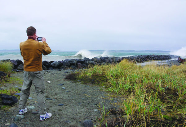
It was a different story at sea level.
Tami Ruby, harbormaster at the Port of Port Townsend’s Boat Haven and Point Hudson Marina, said there was minor flooding at high tide but that the winds had left the marinas unharmed.
A few dock cleats were torn away, but that was about it.
“That was all that was reported,” Ruby said Monday morning.
“It’s just breezy, not super windy,” she said. “Everything seems to be battened down.”
Winds that the Weather Service said gusted up to 47 mph at Neah Bay on Sunday night had muted to 36 mph by 10 a.m. Monday.
“All the boats are in,” Makah Marina Harbormaster Bill Parkin said Monday morning of about 80 to 90 mostly tribal fishing vessels.
At LaPush, the Quillayute River bar was closed Monday afternoon by the Coast Guard captain of the port for the Sector Puget Sound area of responsibility.
The Coast Guard will re-evaluate the bar closure on an ongoing basis, a spokesman said.
The Weather Service did not have precise wind speeds for Port Townsend and Port Angeles from Sunday night, but Gaebel estimated they were in the range of 35 mph.
As of 11:50 a.m. Monday, just two Puget Sound Energy customers were without power in the Discovery Bay area, with the restoration of electricity expected by 1 p.m., utility spokesman Roger Thompson said.
“We had a few small outages in Jefferson, primarily Eastern Jefferson County,” he said.
There were 5,000 PSE customers who lost power in the utility’s nine-county coverage area, primarily in King, Pierce and Thurston counties.
As of midday Monday, 300 were still without power in Kitsap County, Thompson said.
“We did not have much in the way of power outages in Jefferson County as the result of this windstorm,” he added.
In Clallam County, Port Angeles High School and portions of Lauridsen Boulevard were without power for about an hour until electricity was restored at 8 a.m., city Public Works Director Glenn Cutler said in an email.
School began on time.
There were localized outages to homes but nothing major, Cutler added.
Power outages caused mostly by tree limbs shrouded 840 Diamond Point-area Clallam Public Utility District customers in darkness at 5:05 p.m. Sunday, utility spokesman Mike Howe said.
Power was restored by 8:40 p.m., he said.
Then between 6:45 a.m. and 7:15 a.m. Monday, it went out to 154 customers in Joyce, the Atterbury Road area west of Sequim, and on Pierce Road between Blyn and Gardiner, he said.
Those affected areas had power restored by 9 a.m.
“We continue to be ready for further things,” Howe said.
Scattered outages were reported throughout Clallam County, he said.
“When they’re scattered about, it makes it a little more challenging.”
Gaebel said temperatures might drop to the upper 30s tonight in some lowland areas of Clallam and Jefferson counties, they’re expected to rise to the lower 40s by Wednesday.
“It will turn warmer Wednesday afternoon,” Gaebel said.
As for rain, not enough fell to create flooding problems, but it is expected to continue falling today and through the rest of the week, he said.
It was cold enough for the rain to turn to snow on Hurricane Ridge, which recorded 9 inches of new white stuff Sunday night, McKenna said.
The snowpack measured 88 inches at noon Monday near Hurricane Ridge Visitor Center at 5,240 feet.
The road crew was forced to turn around Monday morning at 3,500 feet, McKenna said.
The road is open to the public only on Fridays through Sundays and holidays this season.
Recorded updates are available by phoning 360-565-3131.
The Ridge’s snowpack is about 230 percent of normal, McKenna said.
Senior Staff Writer Paul Gottlieb can be reached at 360-452-2345, ext. 5060, or at paul.gottlieb@peninsuladailynews.com.
