
SEQUIM –– A pair of unmanned watercraft will use laser beams shot into the sky over the next month in an effort to gather more information about offshore winds.
“These two buoys represent a significant new investment by the U.S. Department of Energy to advance the development of wind energy,” said Will Shaw, an atmospheric scientist with Pacific Northwest National Laboratory.
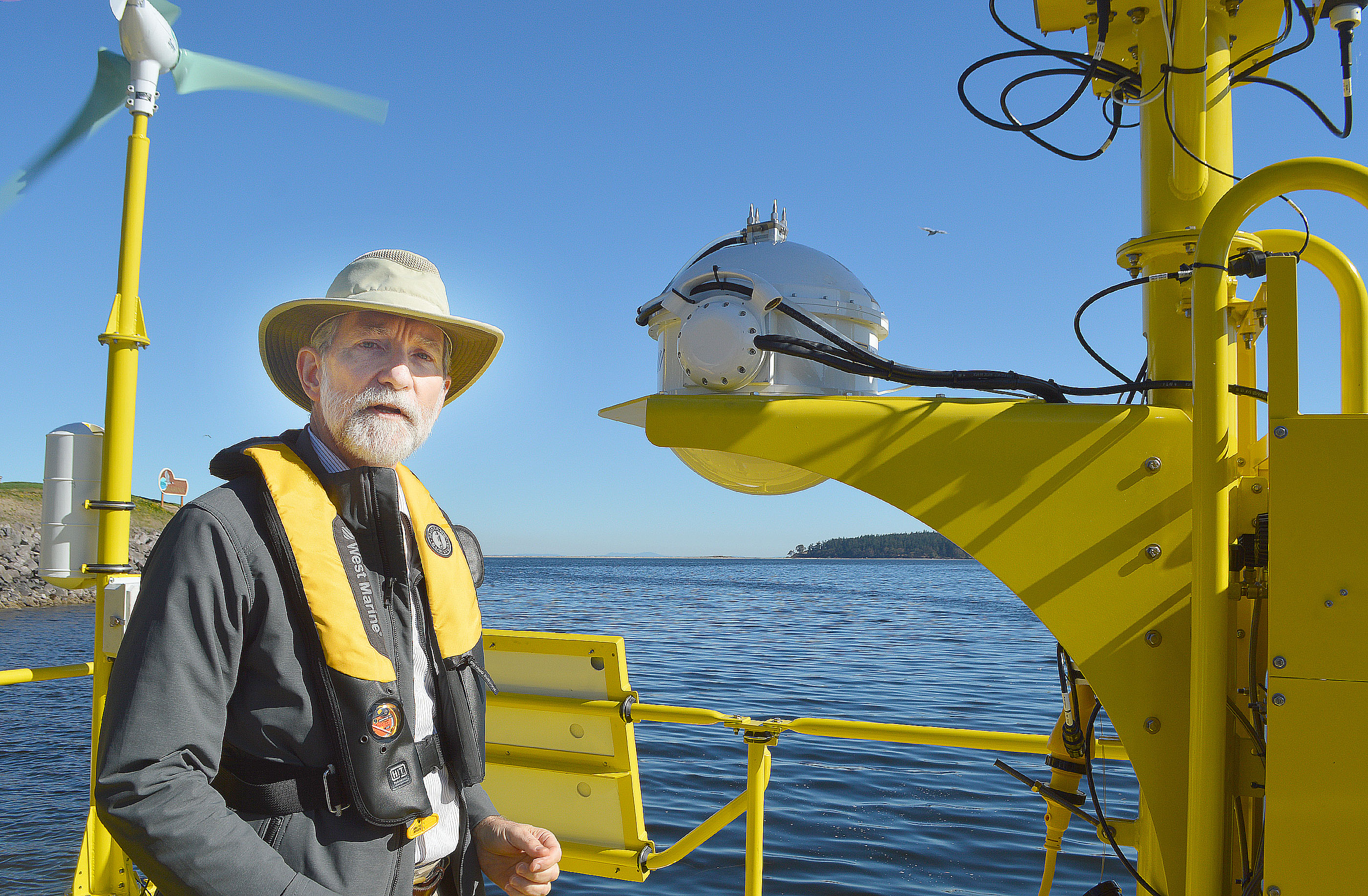
Working out of the national lab’s Marine Sciences Laboratory north of Sequim, the organization is deploying two bright yellow, 10-ton buoys into Dungeness Bay this week, after a test run in Sequim Bay, to see if they will adequately measure wind conditions in hopes they will be able to provide more information about the potential of wind farms off U.S. shores.
What little information private companies have collected about offshore wind power possibilities has been kept an industry secret, Shaw said.
“The lack of that kind of information in U.S. off-shore waters has been one of the most significant barriers in the development of U.S. off-shore wind energy,” Shaw said.
“Uncertainty translates to risks which translates to additional costs to cover that risk.”
Eventually, the national laboratory will post data from the buoys’ testing on a website for the public.
Department of Energy projections say off-shore wind power could eventually produce the equivalent energy of 25 nuclear power plants.
After their test run off Sequim, the buoys will be trucked to a pair of off-shore wind farm demonstration sites; one 18 miles off Coos Bay, Ore., and one 23 miles off Virginia Beach, Va.
Those two wind farms are being assembled by Principle Power of Seattle and Dominion Virginia Power.
Constructed by AXYS Technologies of Sidney, B.C., the $1.3 million buoys carry an array of high-tech devices.
The buoys belong to the U.S. Department of Energy Efficiency and Renewable Energy.
Each is powered by its own solar panel and wind generator, backed up by a small diesel generator that will run advanced scoping devices called Lidar — short for light detection and ranging — that will gauge the speed and direction of winds at different levels by shooting lasers more than 600 feet in the sky, taller than off-shore wind turbines.
“On land, the usable wind is at a much lower elevation than what you can get off shore,” Shaw said.
Changes in atmospheric conditions will send portions of those laser beams back to the buoys, where that information will be recorded, Shaw said.
Shaw noted they have checked with state and federal wildlife agencies to ensure the buoys won’t injure wildlife.
He added the buoys are equipped with instruments that will compensate for the anchored buoys’ motion in the surf.
Other onboard instruments will record air and sea surface temperature, barometric pressure, relative humidity, wave height and period, and water conductivity.
________
Sequim-Dungeness Valley Editor Joe Smillie can be reached at 360-681-2390, ext. 5052, or at jsmillie@peninsuladailynews.com.
